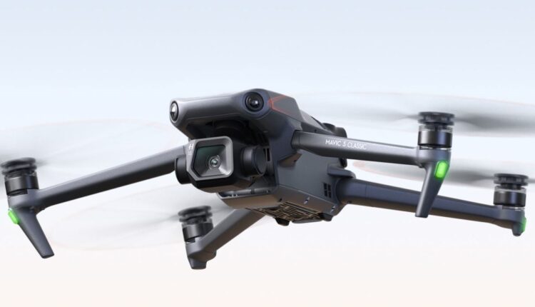
The technology company DJI has announced that thanks to its civilian drones and aerial imaging technology, more than 1,000 people have been rescued from danger around the world.
The manufacturer of these unmanned aerial vehicles has commented that one of the most recent examples of its success took place in New York, when two hikers were lost at dusk and the rescue team could not reach their location because the battery of their phone mobile was running out.
Thanks to the UAS Unit (abbreviations that correspond to the Unmanned Aircraft System) of the Sheriff’s Office, they could finally be found with the help of a drone equipped with a thermal camera, according to a press release.
This would be just one of the hundreds of cases of endangered users who have been rescued thanks to DJI technology, which has recorded the rescue of more than 1,000 people worldwide.
This has been corroborated with the drone rescue data and statistics collected since 2017 by the company, which has done so with the mission of “sharing with the world how important drone technology is for the men and women who risk their lives by those of others,” said DJI’s senior director of corporate strategy.
Drones are key in rescuing people in danger
Drones can be key devices when it comes to rescuing people in danger. An example of this is the case of a teenager who swam in the east coast of Spain in July of last year. When he wanted to return to the shore, it was impossible due to the strong currents of the water. A UAS lifeguard service operating on Spanish beaches then used a drone to drop a life jacket to the young man, saving him from drowning before the rescue team could reach him.
Notably, the DJI Drone Rescue Map tracks incidents where police, firefighters, rescue teams, and bystanders have used drones to save people from danger since the first known rescue in 2013.
Each incident that the company records is entered on the Drone Rescue Map with the location and date, as well as a brief description and a link to the original story, in order to track it in real time. In contrast, DJI’s map and count does not include incidents such as when a drone is used as part of a broader search process, but rather includes those where a drone has directly located, assisted, or rescued a person in danger.
Source: dpa
(Reference image source: DJI, Europa Press / dpa)
Visit our news channel on Google News and follow us to get accurate, interesting information and stay up to date with everything. You can also see our daily content on Twitter and Instagram


